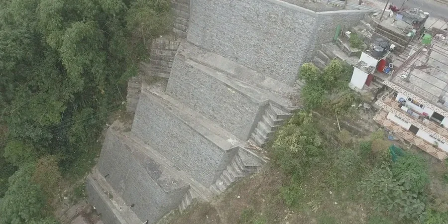
Grand Rapids grew from the riverbanks outward, carving neighborhoods into the bluffs above the Grand River valley. That topography is part of the city’s character—and its geotechnical reality. Glacial outwash sands, lake plain silts, and deeply incised ravines create slope conditions that demand more than a generic factor-of-safety calculation. When a developer proposes a retaining wall along Michigan Street hill or expands a campus near the Belknap Lookout, the first question isn’t “can it hold”—it’s “what happens when the spring thaw saturates the upper ten feet?” A proper slope stability analysis in Grand Rapids integrates site-specific stratigraphy from CPT testing with pore-pressure modeling, because the difference between a stable cut and a slow-moving failure often sits in a thin silt lens nobody mapped.
The city’s average annual precipitation of 37 inches, combined with freeze-thaw cycles that penetrate well below the frost line, means slope performance changes seasonally. Our team reads the landscape through a lens calibrated to West Michigan’s glacial history, where the soil profile shifts from dune sand to compact till within half a block. That local pattern recognition—built across dozens of Grand Rapids projects—turns a desk study into a forecast the contractor can actually work with.
A stable slope in Grand Rapids is one that works under both August drought and March meltwater—designing for only one season invites a surprise.
How we work
Inland Michigan doesn’t see coastal storm surge, but Grand Rapids faces its own slope-stability driver: rapid snowmelt and heavy spring rain on saturated ground. The contrast between dry summer sand bluffs and the same slopes during an April thaw is stark—effective cohesion drops, pore pressures spike, and a slope that stood for forty years can begin creeping in a single weekend. Our stability analysis accounts for that seasonal swing by modeling transient seepage rather than assuming a single water table. We pair laboratory
triaxial testing on undisturbed Shelby tube samples with field shear vane measurements to calibrate drained and undrained strength parameters that reflect real Grand Rapids conditions.
Beyond the river corridor, suburban expansion into former orchard land east of the city introduces cut slopes in layered glacial drift. Here the failure mode often involves a weak clay seam at the contact between sand and underlying till, and identifying that seam requires careful logging—not just blow counts from an SPT. The analysis then evaluates multiple critical surfaces, including those that daylight below the toe of a planned footing, ensuring the
footing design doesn’t inadvertently load a pre-existing failure plane. Every report references current IBC and ASCE 7 requirements, but the judgment behind the parameters comes from years of watching how West Michigan soils actually behave.
Site-specific factors
When the IBC requires slope stability evaluation for structures on slopes steeper than 1:3, Grand Rapids sites often trigger that threshold before the architect finishes the program. The risk isn’t theoretical—shallow translational slides in lacustrine silt have damaged retaining structures along the Grand River, and rotational failures in saturated sand have delayed more than one infill project near downtown. The 2022 edition of ASCE 7 reinforces the requirement to consider both drained and undrained conditions, which is especially relevant here because many West Michigan clays exhibit strain-softening behavior: peak strength governs the first movement, but residual strength controls whether it stops. Missing that distinction leads to slopes that pass on paper and fail in the field.
Deep excavations near existing infrastructure compound the risk—a slope failure behind an occupied building is a different event than one in a greenfield. Our analyses for urban Grand Rapids sites incorporate surcharge loads from adjacent foundations and, when the geometry demands it, we recommend deep excavation monitoring to track lateral movement during construction. The cost of monitoring is trivial compared to the consequence of a slope that moves faster than predicted.
Regulatory framework
ASCE 7-22 (Minimum Design Loads and Associated Criteria for Buildings and Other Structures), IBC 2021 (International Building Code, Chapter 18 Soils and Foundations), ASTM D1586 (Standard Test Method for Standard Penetration Test and Split-Barrel Sampling of Soils), ASTM D2487 (Standard Practice for Classification of Soils for Engineering Purposes), ASTM D4767 (Standard Test Method for Consolidated Undrained Triaxial Compression Test for Cohesive Soils)
Frequently asked questions
When does the building code require a slope stability analysis in Grand Rapids?
The 2021 IBC (Section 1803.5.4) requires a slope stability analysis when a building or structure is sited on a slope steeper than 1 unit vertical to 3 units horizontal (33% grade) and the downslope extent of the slope is steeper than 1:3 for a vertical height of 15 feet or more. In Grand Rapids, this applies to many river-bluff properties, ravine lots, and commercial sites along the Grand River corridor. Even when the code threshold isn’t met, a lender or geotechnical engineer may require the analysis if site investigation reveals weak soils, evidence of past movement, or planned cuts exceeding 10 feet.
What soil conditions in West Michigan most commonly cause slope failures?
The most problematic conditions in the Grand Rapids area involve glaciolacustrine silts and fine sands that lose apparent cohesion when saturated. Spring snowmelt and heavy rain raise pore-water pressures faster than the soil can drain, triggering shallow translational slides on slopes as gentle as 2:1. Deeper rotational failures often occur where a sand layer overlies a stiff clay till—the contact acts as a perched water-bearing seam, and the clay’s residual strength after movement can be significantly lower than its peak value. Lake plain deposits in the lower Grand River valley also contain sensitive clays that lose substantial strength when remolded.
How much does a slope stability analysis cost for a typical Grand Rapids project?
For a single-family residential or small commercial site in Grand Rapids, a slope stability analysis generally ranges from US$1,190 to US$4,230, depending on whether new subsurface investigation is needed and the complexity of the slope geometry. The lower end applies when recent geotechnical data and laboratory shear strength results are already available; the upper end reflects projects requiring dedicated borings, triaxial testing, and modeling of multiple loading scenarios. A site-specific proposal is always provided after an initial desktop review of topography and published soil maps.
Do Grand Rapids slopes need to be evaluated for seismic stability?
Yes. While West Michigan is not a high-seismicity region like the West Coast, the USGS National Seismic Hazard Model assigns a design peak ground acceleration that requires a pseudo-static stability check per ASCE 7-22. For Grand Rapids sites, the horizontal seismic coefficient typically falls between 0.05 and 0.10, which can reduce the factor of safety enough to influence the design slope angle or trigger the need for reinforcement. The analysis uses a reduced shear strength (commonly 80% of the static value for clays) and must demonstrate a factor of safety of at least 1.1 under the design earthquake.